Tuesday, February 28, 2012

Lima Peru and heading for the jungle

On our way to a six day river boat trip on the upper Amazon River we stopped for a couple of days in Lima, Peru. Lima has between 8 and 10 million people, dependent on who you are talking to. We are staying in the district of Miraflores, which is one of the nicest districts in Lima where the rich Peruvians and foreign business people live. It is modern and safe with lots of restaurants, shopping and condos along the ocean. It is hard to believe the contrast to other areas of Lima, such as the shantytowns with no water or electricity, mostly made up of country people looking for a better life!

Beach in Mira Flores, Peru
Lima is an old city and the architecture reflects the different ages and influence of European styles of construction. The main downtown pedestrian street has varied styles, a 1700 French style, beside an 1850 style Italian, next to a 1980 modern building with some colonial Spanish across the street.

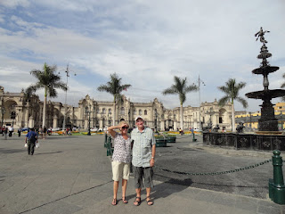
Loreen and I in front of the Presidential Palace of Peru
We visited the huge Cathedral of the Franciscan Order with art from the 1600s, murals of the life of St Francis of Azzi, the founder of this Order. There were 36 murals in all done by some Italian artist, they do not know who. These murals, painted on white washed adobe walls, had started to deteriorate and were covered up by canvases of the very same scene painted by local artists and were just discovered a few years ago when they took the canvases down to restore. There was also one room of four by eight foot canvases depicting the life of Jesus that came from Rueben's workshop.

The Cathedral
Then into the catacombs, where they estimate that some 70,000 people were buried. There are many areas about four meters deep, three meters wide and four meters long full of bones and skulls, all original, none made in China, our guide said. They filled these areas with bodies and lime and when they ran out of room they would dig them up and move the bones to a round pit about twenty meters deep and drop the bones in there. It is just amazing.

We met our 21 travel partners and all went out to dinner on the G Adventures. It is a good group of mostly middle aged Canadian couples.

Then off to Iquitos, a city of about 400,000 inhabitants and 70,000 motokars which are noisy three wheeled motor bikes with a two passenger seat. The only thing I can say about Iquitos, is you have to go there to get on the upper Amazon River. It is accessible only by air or boat.

Our six day boat tour was cancelled due to boat problems so the tour operator booked us into a luxury lodge located about 40 kilometers downstream from Iquitos on the main branch of the Amazon River.

On the way to the lodge we stopped at a manatee rescue/research center. The fresh water manatee in the upper Amazon are endangered and they have set up a center where they rehabilitate injured and orphaned manatee and get them back to health to reintroduce to the wild.

Then on to the boat for our two hour trip down river to the lodge. We were on the river after dark and the captain navigated with no lights, which was pretty scary for the amount of debris coming down stream due to the high water. Once in awhile we would hear some motor running and think it was a generator on shore, but no it would be another boat meeting us on the water, some of these had no lights whatsoever, you would just see the silhouette go by off the side.

The lodge consists of 75 individual cabin and a large central complex of lobby, dining room and bar, complete with swimming pool, slide and a hammock area for siesta. All the meals are buffet style and everything but alcoholic beverages are included. Although the river boat and sleeping on the river would have been a lot of fun, I am sure that the lodge is an upgrade and it seems like it will work out well.

The lodge has a few resident birds and animals, a scarlet macaw,


 a juvenile tapir,


a young deer


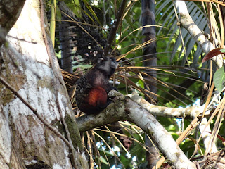
 and a few transient monkeys.


All but the monkeys are friendly and like to be talked to and/or petted.

Our guides, Willie and Cesar, tell us there are no seasons here, just high water and low water. High water peaks in May, it must be something as whole islands in the river are now covered with water. Some people have moved from their homes and some plantations along the river are flooded out and will need to be replanted.

On the Amazon

Tuesday, February 21, 2012

Sedate Sucre and Manic La Paz

It was a three hour drive from Potosi to Sucre through mountain valleys and farm land. There are big farms growing barley for beer, and small farms with a multitude of livestock, such as goats, sheep, cattle and llamas all grazing together, and a few burros used for transportation.

Moving cows in Bolivia


Through some of the villages we would encounter dogs lying on the shoulder of the road, now why would a dog want to just lay on the road? Loreen finally figured out that where there was a dog there would be a flock of goats grazing nearby and that the dog was there to keep the goats off the road. Amazing, as the dogs were of just about every breed.

Sucre, called the City of White, is the nicest city we have seen in Bolivia, I will get to La Paz later. It is a requirement of the downtown core to white wash the buildings every year, so Sucre is clean, and no brown brick or grey cement or adobe buildings as in the other Bolivian cities we have been to.

City of  White

This was originally a village of indigenous people because of the presence of two rivers and was also a sacred site. Colonization came from the Spanish mine owners from Potosi wanting a more favorable climate and altitude to raise their families and Sucre was established sometime in the late 1500s. It was the center of the South American cry for independence and declared itself free of Spain on the 25 of May, 1809. Full independence was granted 16 years later.

Many of the buildings are built in a square with a central courtyard, this was done so that the rooms would receive light and air from two sides. The hostal we stayed in was a sixth generation family home converted into a hostal, spanish for hotel. It was four stories with twenty some rooms (each with private bath), dining area, courtyard and still a living area for the family. It was a good example of the wealth of the mine owners.

Bolivia is a poor, poor country, one of the poorest I have been in anywhere, and it is reflected in the stature of the villages and the cities. Mines still operate here, with one of the largest silver mines in the world, but very little is paid to the people that work there, and although they are not in poverty as most of the country, they still cannot afford good housing or safe water. Sanitation is mostly non-existent in any but the better hotels that cater to the tourist trade and perhaps the city centers. But what can you expect in a country that has a record of political strife, 190 some governments in 170 years.

La Paz, nothing previous in Bolivia could have prepared me for the manic energy and wall to wall people, traffic and street vendors of La Paz. In fairness we landed there the week before Carnival weekend, so it was busier than normal, but Keenan assures me not much. Cars bumper to bumper, moving at about five feet per minute, street vendors on both sides of the street, people crossing at all points and walking up and down the streets between the vehicles. Cars honk at each other constantly, a car gets stopped at an intersection, even for a second, the whole block behind them honks! It was absolutely manic.
Main Street La PAz


The downtown of La Paz is situated in a big bowl, maybe 1000 feet of steep descent, and all the streets funnel down into this central area. The first evening when we returned from dinner it was raining hard and the water was four and five inches deep in the streets (no storm sewers here!) We got soaked!

The street vendors were setting up for carnival weekend, so as well as the usual day to day vendors, there were vendors selling confetti, carnival sweets, masks, costumes, fireworks, home made alcohol, fetishes and probably any thing else you had a desire for.

Traditional Bolivian Dress


Keenan took us for a stroll through the side street markets, where the locals shop, although the city did build a big commercial area and moved a huge number off the streets, there are still a multitude of street shops, little stalls six by eight where the vendors bring the goods in the morning and pack them up and take them home at night. The whole city appeared to be one big market.

The most intriguing was the witches market. Although most Bolivians are Christians, it seems they all still stick to the old traditional indigenous religions as well. So you buy a llama fetus to bless your house with, any sort of charm, plant, dried bats, frogs, rodent mixtures for good luck, health, love potions, bad luck spells for that guy down the street with more money, basically anything your little heart desired. It was startling when Keenan yelled "Dad, look behind you" and I turned to be face to face with a dozen llama fetus in various states of maturity, some still not quite desiccated and giving off a bit of odor. Also to be bought were offerings to Pachamama Mother Earth, which is the goddess of all gods in their religion - the richer you are or the more you need her blessing, the more you add such as sweets in the form of many plants and animals, herbs, etc., then you take this to a sacred place or your house and offer it to Pachamama by burning the offering and praying. I did not go so far as getting one of these, but I did buy a three headed Pachamama statue to bless me, you know the saying, three heads are better than one!

Wednesday, February 15, 2012

Potosi

We took the bus from Uyuni to Potosi, in places a one lane dirt road that is so narrow the front of the bus seemed to be hanging out over the edge of the cliff going around corners. At least it wasn't a chicken bus, where the passengers get on with their chickens and vegetables for the market, although it did stop every time someone flagged it down on the side of the road.


Road to Potosi

A few times, going downhill, our bus had to back up the road until it found a wide enough spot to let the vehicles coming up get around us. Unfortunately Loreen was in the front window seat and was scared to death, after the five hour bus ride I have finger print bruises from my knee to my shoulder!

All through high mountain passes I cannot believe how these people eke out a living trying to farm on their small pieces of land hanging on the edge of the mountain, living in stone homes with no heat that we could see, and it does get cold here. Bolivia, like other South American countries, seems to have had a sucession of governments more concerned with their own wealth than the well being of the people.

Potosi, wow, this is the Bolivia Keenan has tried to prepare us for. I am amazed, bewildered and confused all at the same time. The highest altitude city in the world, Potosi is a maze of single lane streets hanging on the mountain. Cars, buses and people all compete for space in the street, crossing when there is a break in traffic, and even at the cross walks cars take priority. They don't stop at intersections, just honk, I guess who ever has the loudest horn has the right of way.

Ladies visiting on the street

Once the largest and richest city in the world because of rich silver mines here, Potosi is now the poorest city and province in Bolivia, which would make it the poorest in South America. The first mining was done by an indigenous man in 1544, but was taken over by the Spaniards in 1545. Local indigenous peoples were taken as slaves and forced to work the mines, and one Spaniard mine owner even took a bunch back to Spain as slaves when he returned.


Potosi Silver Mine

Today the silver is mostly played out and all the big owners have left. Potosi survives on what mining is left, but it is now done through local cooperatives that the miners themselves own. The type of mining done is very dangerous underground mining, sometimes through passages so small that one must crawl through. The miners' life span is very short due to lung disease, but the widows get a ten dollar pension per month!


The Yellow Building was a family home

During its glory years - 1545 to the late 1700s - a total of 36 large churches and cathedrals were built, today 8 are open, the rest have closed including the Saint Teresa convent, which was the safest place to put your daughters due to extreme violence in the city. The mine owners and other wealthy families also built huge mansions here, some of which now have been turned into hotels and government offices.


Front of Church that was never finished

Now we are off to Sucre, a few hours away, at lower altitude and where the really rich mine owners lived.

Bolivia, sleeping in Rock Huts and Salt Hotels

Leaving Chile we spent an hour getting through the Chilean border, which is the main border checkpoint to both Bolivia and Argentina, and it is almost as hard to leave Chile as it is to enter. Then off to Bolivia we go, our driver assured us that the crossing into Bolivia would be a lot quicker. Up over a little rise and there was Bolivian border control, one small building with two border control guys, quick look at the passport, entry stamp and away we go. Five minutes maximum.

Bolivian Border Crossing
After transferring our luggage from Jose Miguel's jeep into Wilson's jeep, apparently the red tape involved to cross the border with clients is incredible, so one driver in Chile, new driver in Bolivia, we set off through the Altiplano traveling north. It is a high altitude rocky desert in the middle of mountain peaks, some of which were volcanic, at least one is still active with steam coming out.

 The Altiplano is now a national park and is part of multiple-country effort to protect the sensitive terrain and several species of flora and fauna that are threatened with extinction.
Within the vast mountain desert ranges are a number of lakes named after the color of algae in the water, Laguna Blanco (white), Laguna Verde (green) and Laguna Colorado (red). The brighter the day the more color in the water. All these lakes support massive flocks of South American Flamingo, which was a surprise to me finding these sea level birds at 4500 meters in elevation.
Laguna Colorado


Laguna Blanco

 Animals here consist mainly of llamas and vicuña, both of the camel family. Llamas are mostly owned by indigenous farmers and are the largest of the four South American camel families. Vicunas are a much smaller undomesticated animal.

Vicunas
There are also foxes, small wild cats and various types of smaller rabbit and rodents. Most are very rare and sightings are special. We did however find one little rabbit hanging out on the trail looking for treats.

Bolivian Rabbit

The first day we climbed to 5000 meters which is much too fast to acclimatize and we all suffered from a bit of altitude sickness. At lunch we were short of breath and as the day went on we all had migraines and felt like we had the flu.

Lunch in the desert

Then Keenan and Loreen sampled the waters at a hot pool in the middle of the Altiplano.

Hot Pool

 That night we stayed in a rock hotel on the Altiplano that is managed by a local Indigenous family. The hotel is totally constructed out of native rock, except the bed frames which were concrete. The generator is turned on from 6:00-10:00 pm, and then lights out. The water is heated with solar power so you have to make sure you take your shower when you arrive. With the hotel located at 4400 meters, the nights get very cold, in fact there was ice and some snow the next morning. We all spent the night with splitting headaches and insufficient sleep. We still enjoyed the day, our guide/driver, the hotel and the staff, if not the night.


Rock Hotel

Next morning after cold water washes (a good way to wake up), we enjoyed a nice breakfast accompanied by cups and cups of mate de coco, a tea made from coco plant leaves that helps fight altitude sickness. Then off down the trail on a 200 kilometer drive to Uyuni and the Salar (salt flats).

We descended through some pretty wild mountain passes, including one that is located on a portion of the Inca trail used to go between Peru and northern Chile and Argentina. This pass is one vehicle wide through broken shale rock with house size volcanic rocks sitting on the slopes above the trail, seemingly just balancing in the shale. I was thinking that this little pass must be pretty wild with water flow as the snow in the highlands melts.

Pass got steeper and the rocks bigger as we descended

 The altiplano is located amongst a number of old volcanic mountains that have spewed forth huge volcanic rocks. These rocks are scattered across the altiplano and some are the size of large buildings and come in various shapes. Some of the formations have been caused by wind and water erosion while others are the result of the molten rock cooling. One are called the rock garden is several kilometers in size.

Volcanic rock named the Tree of Life

Volcanic rock named the Condor

Tonight we stayed in a hotel located on the edge of the salt flats. The hotel is totally made of salt formed into bricks and then built like a brick house. Only the roof was not salt, but made of poles covered with reed mats. It did have all the amenities, hot water, etc., but no electricity. Seems a thunderstorm had taken out the electricity between the hotel and the village, so we dined by candle light, not sure what we ate, but it tasted good!


Built entirely of salt

Inside the Salt Hotel

Then the salt flats, an area some 12,000 square kilometers of salt from centimeters to 28 meters in depth. Blinding white for miles and for vast areas no horizon, just a vague line where the salt and sky meet. As it is the rainy season large portions of the flats were covered by water, and as the surface looks like ice, I wondered about breaking through. There are areas where you can get bogged done in the salt, but the tour drivers and village buses that roar back and forth are well aware of the bad areas, so we had no mishaps.

12,000 square kilometers all the same!

Our guide/driver set up a nice picnic table and chairs on the salt for our lunch. We dined on llama schnitzel, quinoa (an ancient grain), green salad and Bolivian wine.

Loreen putting me in my place
Keenan, Wilson and Loreen having llama lunch

Then back into Uyuni to visit the train cemetery. It is amazing what you can make into a tourist attraction, this one, the retired engines and cars from the Bolivian train system. As a main terminal for trains, Uyuni received all these retirees and shunted them off to a couple of side tracks. A number have been cut up for parts, mostly it seems to recover the tubing from the boilers. Now a play area for locals and a draw for tourists, these trains sit there and quietly rust away.
Heading out for the hills

Keenan swinging in the playground


Passenger car that missed the corner


This ends our Salt Flat/Altiplano portion of Bolivia, tomorrow a bus ride through the mountains to Potosi, once the silver capital of the world.

Sunday, February 12, 2012

Resort Cities and Adobe Pueblos

We've travelled back over the Andes into Chile, making a brief stop in Santiago before continuing further north. Loreen and I took it easy, as we'd already visited the city, although Loreen did narrowly avoid getting her watch snatched right off her wrist by a little thief! Keenan took a city bike tour, and we introduced her to our favorite Chilean cuisines.

We also took the funicular to the top of Cerro San Cristobal, an 863 meter high mountain in the center of the city that has been made into a municipal park, with amazing views of the city and surrounding mountains. The big draws on the mountain are the cathedral, statues of Jesus, one of the Pope and some Saints, plus an open air theater area for church services that probably hold several hundred.

We then travelled by bus to Norte Chico region, or the little north region to a city on the ocean, La Serena. Chile is some 4300kms in length from the Atacama Desert to the southern most tip in Tierra del Fuego, and only averages 175kms in width. During that 4300kms there is a great difference in climates, terrain and vegetation capability.

Semi-Arid Desert
 We have been to alpine, tundra like areas in the far south, shrub and grasslands of Patagonia, the lakes, mountains and streams of the lakes districts, the fertile valleys of Central Chile and now are moving into the desert ares of the north. On the seven hour bus ride from Santiago to La Serena we passed through vast areas of desert like country, (sand, rock, shrub, cactus and I guess grass), being grazed by goats and a few horses. I think the goats had to pack lunches to get from one grass area to the next. Then into a valley with a stream or river between the mountains and the coast, these areas are all farmed, citrus, avocado, flowers, melons and vegetables. Farming in these areas is a hard job, they are still using a single horse and a walking plow or cultivator to till the land in some areas and all the harvest is done by hand.

La Serena is a beach tourist area, and Calgary circa 2006 with all the condos being built. We opted to stay as close to the beach as possible. Approaching the hotel, during the summer holidays, had both Keenan and Loreen wondering what we got ourselves into as we drove past hoardes of 14 year olds skateboarding, giggling and loitering in front of the mall. The beach area is Penticton on steroids: amusement areas, packed beaches, but not another English speaker in site. What fun, eh! We mostly just took it easy in La Serena, walked on the beach, laid by the pool, cooked our own meals.

La Serena

Then off to San Pedro de Atacama, situated in the Atacama desert, the driest desert in the world. It was a special day! We had a flight to Antofagasto scheduled for 1:30 and we were told to be there three hours in advance, we showed up 2.5 hours before and the counter was not to open until an hour and a half later. When it opened we checked in only to find out the plane was actually delayed and would not leave until 2:30. What to do in an airport for four and a half hours, but sit and contemplate the scenery.

New Condo Construction

Antofagasto, is the main port city for all Chilean imports and exports by sea. The total northern area of Chile was once under Bolivian control, but taken away in the "Pacifico War" of the late 1800s. Bolivia has been angry about the loss to the coast ever since. They not only lost a sea port but a very mineral rich area. The city is located at the edge of a vast mining area. The mines here are copper, nitrates and lithium and Chile produces around 35 percent of the worlds copper.

What can I say about Antofagasto, located on the edge of the desert, nothing but brown sand and rock as far as one can see. No beaches to speak of but lots of rocks and steep cliffs, even so there was a multitude of people camped along what beach there is. We went straight to the bus station for our bus to San Pedro, which was two hours late. What to do in a bus station for three hours, well have lunch, watch the pigeons fly, dogs and cats beg for food and wander around the restaurant. The pigeons had fun dive bombing Loreen, while a sad looking dog lay at Keenan's feet, finally a lady came and shooed everything away.

Outside of Antofagasto, Chile, train to the mines

Leaving the city the road climbs up through a set of reddish brown rocky hills and then miles of flat desert, carved up with cat trails, haul roads, open pit mines and processing plants. I got some flack down here about the oil sands, but think the mines in the Atacama desert and the balance of northern Chile is probably just as large. I need to google earth it!

Into San Pedro at last, arriving at the bus station at midnight. It was an adobe corral type of station, with no one around and no taxis in sight. So with the trusty map from the Lonely Planet and Keenan asking where the main plaza was, off we went, two of us with our backpacks and Loreen pulling her wheeled suitcase down the cobblestones streets. San Pedro was in full party mode, with lots of people on the streets and in the bars. We must have been quite a sight, this young lady being followed by this bewildered older couple through the dusty streets of San Pedro, at midnight. I might be getting too old for this backpacking stuff. Finally we find the hotel, the front gate of which was padlocked shut, so Keenan had to head up the road in search of a phone. The poor guy thought we ditched him. We managed to get checked in and settled down for our first night ever spent in a mud and straw adobe building. But the room was nice inside and the folks running the hostel were exceptional hosts.

Our Adobe Room
 You can see the Andes off to the east of San Pedro, otherwise it is miles of sand and rock desert. The village itself is adobe homes and fences, on every street. It seems like a straight tourist town where lots of South Americans and a few Europeans come to kick off tours of the Bolivian Highlands and Salt Flats, or to just hang out and have a good time. Mostly backpackers, mostly with dreadlocks -Loreen and I fit right in!

The girls heading home in San Pedro
 Maybe the most outstanding feature in San Pedro is the church, built in the mid 1600s of mud and straw adobe, it is still in use today. It dies get a new coat of white wash every couple of years

Four hundred year old church
From here we are making our way into Bolivia, which Keenan has tried to adequately prepare us for.

This mountian is split by the Chile-Bolivia border

Friday, February 3, 2012

Argentine Wine Country


Mendoza, Argentina is just on the east side of the Andes mountains and is situated in a fertile desert valley that is the largest wine producing area of Argentina and has made Argentina the fifth largest wine producer in the world. As well as vineyards there are vast olive, fruit and vegetable farms in the area. Peaches and field tomato harvest is in full swing and while traveling on buses we would meet or pass semi-trailers loaded with crates of fresh picked produce. Road side stands are full of fresh fruits and vegetables. 

Loreen and I spent a couple of days looking at the plazas, the parks and the city in general. The city was laid out with a central plaza, which is four city blocks in size and then has four smaller plazas situated equal distance from the main plaza. There is also a huge park that includes a two kilometer long man made rowing lake and a world class soccer stadium. 
Mendoza Rowing Club
Our daughter Keenan, joined us in Mendoza and will complete the balance of our trip with us. She was in the process of moving back to Alberta from London and as I was in a place where I was considering canceling the balance of our trip she opted to come and act as our translator. 
Keenan, the translator
After she joined us we took an independent bicycle winery tour, but we got caught up in just biking through the countryside and only made it to one winery and lunch. I am amazed by the irrigation systems. It is all flood irrigation through an intricate canal system. The Mendoza river has been completely drained and switched to canals. They are running water as far as 25 kilometers in some places. When the Spanish settled the area they found irrigation canals that had been built by the Incas and expanded the system to what it is today.
Biking in Argentina
We took our last winery tour in South America out of Mendoza, a half day tour that featured one mediocre winery, a very modern upscale winery (Vista Andes), with wines worth buying if you find them, and an olive oil farm and factory. Wineries are wineries, some just a lot better than others, but the olive oil farm was a new experience for us. Olives are hand selected and then are crushed, pits and all, in a large stone tub, by large stone grinding wheels. Then the mash goes through a hydraulic press to extract the oil, then the oil is filtered and on into the bottling room. 
Cows grazing in the Olive Trees
The wineries are well established and some produce very good wines, mostly for export to Europe and the US. The Argentinian wine industry crashed in the 1970's as people switched to beer and coco-cola like products and just now is in a resurgence due to producing an exportable product that is in demand.

Then off to San Raphael, a small farm/tourist community about a three hour bus ride south of Mendoza. Although our main goal here was to visit a high school friend of Keenan's, Sam Mottishaw, who spends his winter here, we managed, through Sam's help to have a really enjoyable experience.

Sam helped us move from a less than totally fine hostel to a small hotel in the country and took us to a lovely ice cream parlor. This is the kind where they make the ice cream in house and have 26 flavors, yum-yum. Then to a friends home (the friend has duel Argentinian/Canadian citizenship and works in Canada part of the year) for a true Argentinian asado (meat cooked on an outside grill). The Argentinian asados are a time to visit friends and family, drink, debate politics and generally spend the better part of a day or night or both just having a good time. I learned a lot about the Argentinian political makeup during the evening from various viewpoints, a Canadian that lives there, an Argentinian that also has Canadian citizenship and has lived about half and half between the countries and a fourth year university student who has never been out of Argentina, what a debate when they discussed in English.
The Asado Grill 
We also sampled the Argentinian drink fernat, which is mixed with lots of ice and coco-cola and still tastes like a bit of oil sands in your mouth. It has a high alcohol content and could sneak up on you pretty quick. I manned up and had the mandatory one glass full and then went back to a nice mild beer. 
Sam, in the beard, and his friends
The next day we took the bus out to the main tourist attraction, Valle Grande, located in the Canon del Atuel. The Canon del Atuel is a rugged, rocky valley similar to the Grand Canyon. The upper water of the Rio Atuel has been dammed off for hydro production, but below the dams, Valle Grande has a number of small tour operators that provide rafting, Cool River (float tubing) and kayaking. While Loreen and Keenan mastered the wild Rio Atuel on float tubes, I stayed ashore as the designated photographer. Actually I just didn't push myself out of my comfort zone that day, I am really proud of the girls though.
The girls and Cool River
A day of rest at the hotel pool and then back on the bus in the morning for a nine hour trip from San Raphael-Mendoza-Santiago, Chile.